Using Keep Wild
Keep Wild does one job: it shows you the protected land you can't operate a drone from. Everything else in the app exists so it can still do that when you have no signal.
Read this bit first. Keep Wild never tells you a flight is fine. When the screen is quiet, all that means is it found no National Park unit and no Designated Wilderness where you're standing. That's the entire claim. It isn't a green light, and it never turns into one.
Airspace and LAANC, active TFRs, state, local and tribal rules, and whatever state parks and wildlife refuges have decided this year are all invisible to this app. Still yours to check, before every flight.
Say yes to location
iOS asks on first launch, and Keep Wild asks for While Using the App.
Change your mind whenever you like in Settings ▸ Privacy & Security ▸ Location Services. The map still works without it; it just can't work out which protected areas you're standing in.
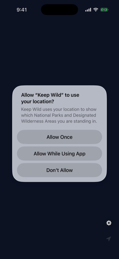
Read what's there — and what isn't
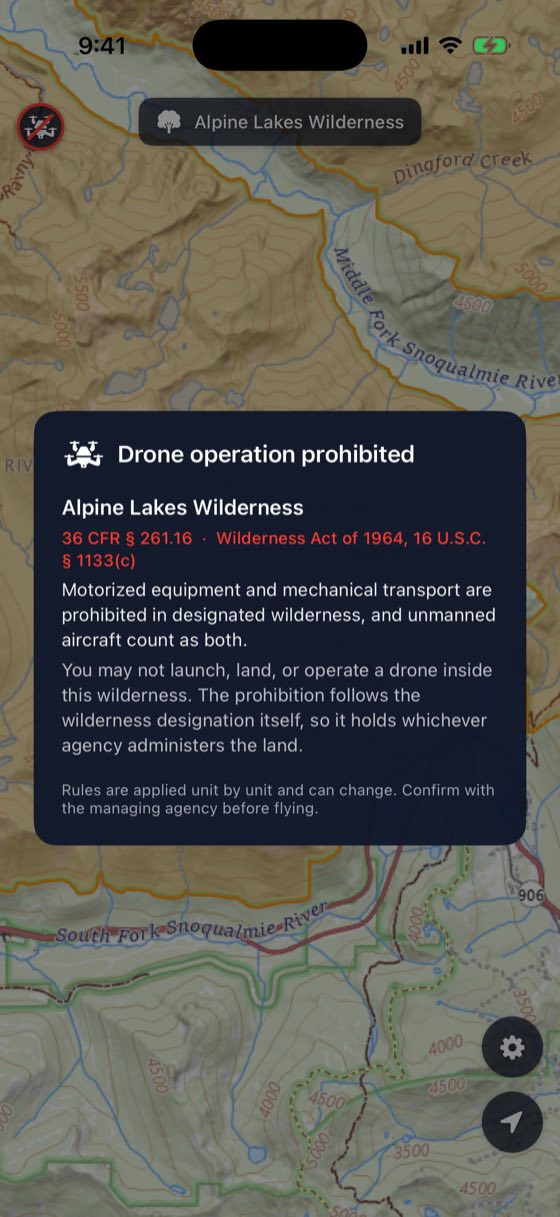
Stand inside a National Park unit or a Designated Wilderness and Keep Wild marks it and names every area involved. Tap the marker for the rule that closes that land, quoted with its citation rather than summarised.
Stand anywhere else and the app goes quiet. Quiet only means it found no such boundary. It isn't a verdict on your flight, and treating it as one is the single mistake Keep Wild can't save you from.
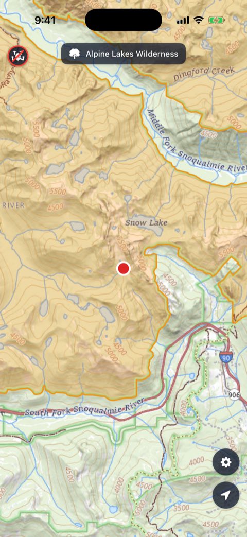
Read the map
Shaded ground is ground you can't operate a drone from. Red-orange is a National Park unit. Orange is Designated Wilderness. They overlap more often than you'd expect, which is why the app lists all of them instead of just the first one it finds.
The dot is you, and it turns red the moment you're inside one. That's the thing to watch, because these rules turn on where you're standing rather than on the air above you.
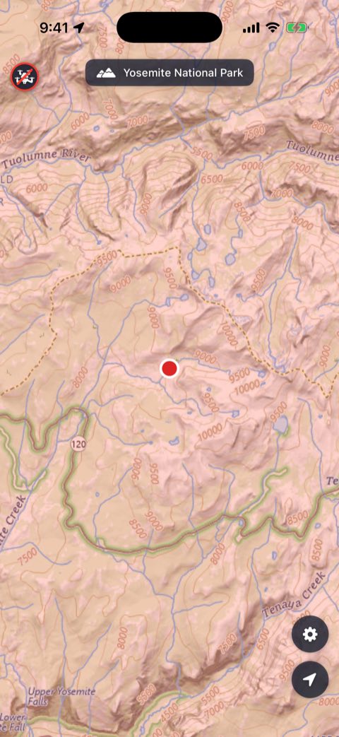
Go and find a boundary
This is the genuinely fun part. Wilderness edges are invisible on the ground — no fence, no line, quite often no sign either. Open the map, walk towards one, and you can catch the exact step where you cross it: the dot flips colour.
Do that once or twice and you stop guessing about where protected land begins. It sticks in a way that reading a regulation never quite does.
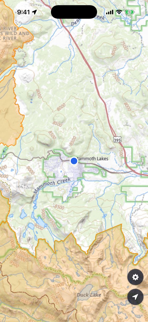
Hand it to someone else
The other use for all this. When you come across someone about to launch in a National Park — and you will — the app turns an awkward conversation into a short one. Show them the shaded ground they're standing on, tap the marker, and let the regulation speak for itself.
Most people genuinely don't know. Very few argue with a citation.
Download before you go
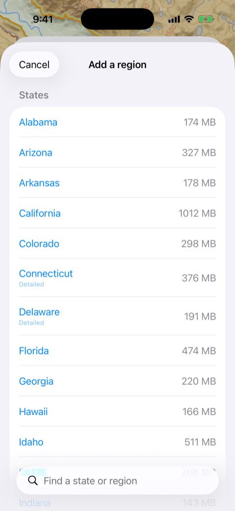
Do this at home, on Wi-Fi, while you still have bars. Open Settings ▸ Offline maps, tap Add a region and pick the state or territory you're headed for. The list is searchable and grouped into states, Alaska, and districts and territories.
Map tiles and boundaries come down together, so a finished region still draws the closed ground in airplane mode — not just a picture of a map.
Regions go Queued → Downloading → Ready offline. You can pause and resume, and swipe one away to delete it. Only Ready offline means the lines will be there in the field.
Keep Wild caps itself at roughly 3 GB and shows what you've used. If a region won't fit, delete one you're done with.
Check where the lines came from
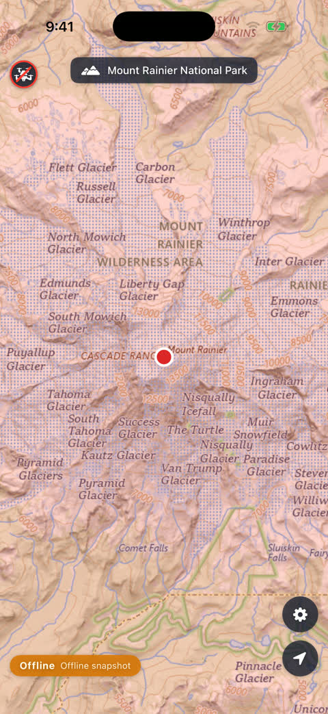
Bottom left of the map, a small badge says which of three states you're in and where the boundaries on screen came from. It's worth a glance before you launch.
Online means no downloaded region covers you and the boundaries are being read live. Mixed means you're inside a region you downloaded and still have a signal, so the map comes off your phone and the lines are refreshed live. Offline means no signal, and both come from what you downloaded.
The rest of the badge names the source: Live boundaries, Offline snapshot when they came out of a download, or Cached boundaries when nothing reached the agencies and the answer came from what your phone had kept.
One state matters more than the others. Offline · No boundary data means no signal and no downloaded region covering you, and a warning takes over the top of the screen. It doesn't mean the ground is clear. It means Keep Wild has nothing to tell you about it — which is a reason to leave the drone in the bag, not a reason to launch.
About those lines
Boundaries come from the agencies' own published data, and they're as accurate as the agencies make them. Near an edge, treat the line as a rough guide — GPS error and boundary error stack up. Give it a wide berth.